
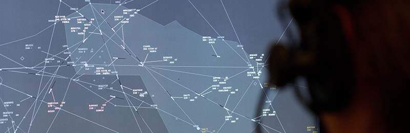
An Indra-led consortium of 28 participants is developing solutions and procedures to provide a single and precise view of air traffic movements across Europe.
The Four Dimensions Trajectory Management (4DTM) project will ensure that air navigation service providers (ANSP), airport operators, and airlines share a single harmonised air traffic view that is updated in real time with the movements of both civil and military aircraft throughout Europe.
Go deeper with GlobalData

Discover B2B Marketing That Performs
Combine business intelligence and editorial excellence to reach engaged professionals across 36 leading media platforms.
Run within the framework of the Single European Sky Air Traffic Management Research (SESAR) project, 4DTM is funded under the EU’s Horizon 2020 research and innovation programme.
It will work with air traffic ground control centres, the European Network Manager, and airport operators to process both data on trajectories handled by aircraft and data used for flight planning by flight operations centres.
The project will then synchronise flight trajectory data and develop new tools to enhance the availability of precise and harmonised aeronautical and meteorological information.
This will help detect any unexpected situations that may result in delays and require adjusting scheduled operations.
4DTM enables definitive implementation of flights using four dimensional (4D) trajectories across the entire continent, which allows aircraft to select direct routes, optimise fuel consumption, cut carbon emissions, and reduce costs.
The Indra-led consortium comprises companies including navigation service providers, technology firms, and research bodies from the EU, Norway, and Switzerland.
