
Nasa is planning to launch its first Earth science small satellite constellation by December.
Set to be launched from Cape Canaveral Air Force Station in Florida, US, the cyclone global navigation satellite system (CYGNSS) will track hurricane intensity, as well as provide forecasts of wind speeds and storm surges.
Discover B2B Marketing That Performs
Combine business intelligence and editorial excellence to reach engaged professionals across 36 leading media platforms.
In addition, the CYGNSS mission will measure new details that will help understand the formation and intensity of tropical cyclones and hurricanes.
Competitively selected through Nasa's Earth Venture programme, the mission will further use the commonly used GPS technology to measure the surface roughness of the world's oceans.
Data to be provided by CYGNSS will be employed to calculate surface wind speeds, providing a better picture of a storm's strength and intensity.
CYGNSS mission principal investigator and University of Michigan professor Chris Ruf said: "Today, we can't see what's happening under the rain.
"We can measure the wind outside of the storm cell with present systems. But there's a gap in our knowledge of cyclone processes in the critical eyewall region of the storm, a gap that will be filled by the CYGNSS data.
“The models try to predict what is happening under the rain, but they are much less accurate without continuous experimental validation."
Capable of breaking through the heavy rain of a hurricane's eyewall, CYGNSS is expected to provide data about a storm's intense inner core.
Once launched, the mission’s satellites, each of which can capture four wind measurements per second, will constantly monitor surface winds over the oceans across Earth's tropical hurricane-belt latitudes.
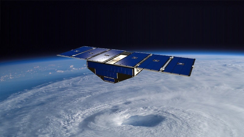
Image: Artist's concept of one of the eight yclone Global Navigation Satellite System satellites deployed in space above a hurricane. Photo: courtesy of Nasa.
