China has successfully sent its third mapping satellite of the Tianhui-1C series into orbit from Jiuquan Satellite Launch Centre in the northwestern province of Gansu.
China previously launched a satellite in the series in 2012.
Discover B2B Marketing That Performs
Combine business intelligence and editorial excellence to reach engaged professionals across 36 leading media platforms.
The satellite aims to enhance the country’s ability to carry out scientific research, mapping and disaster relief using stereo-topographic techniques.
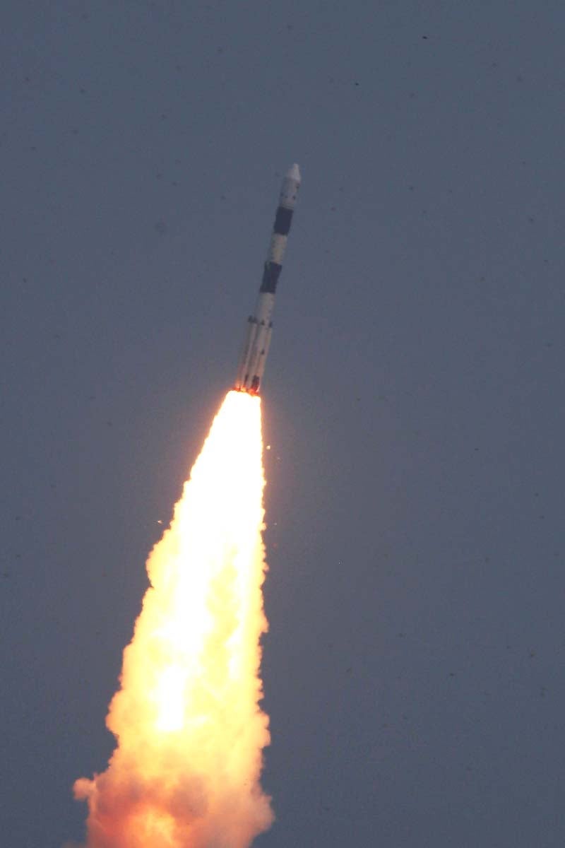
Tianhui-1C was launched aboard a long march 2D carrier rocket. It was the 215th launch of the long march series of rockets and 228th Chinese orbital launch.
The satellite was built by Hangtian Dongfanghong Weixing along with the Chinese Academy of Space Technology (CAST). Tianhui-1 satellites are part of the Ziyuan programme that covers various civil and military earth observation and remote sensing programmes.
Center for Earth Operation and Digital Earth (CEODE) and the Brazilian INPE (Instituto Nacional de Pesquisas Espaciais National Institute of Space Research) jointly operate the satellites.
The Ziyuan-1 programme was focused on Earth resources and has two distinct military and civil branches. Ziyuan-2 programme is used for aerial surveillance, operated by Chinese People’s Liberation Army (PLA), and Ziyuan-3 series will be used for stereo imaging.
Tianhui-1 is equipped with two deployable solar panels for energy generation that is stored on onboard batteries. It also has a three-dimensional survey camera and a CCD camera with a ground resolution of 5m and a camera angle of 25°.
A multi-spectrum camera was attached to the spacecraft and all cameras onboard are capable of producing images of 60km wide.
In 2010, the first Tianhui-1 mapping satellite was launched as a demonstration mission for the use of a stereo imager to gather topographic data from orbit.
Tianhui-1B was launched to provide a follow-on capability after the three-year service life of the first satellite.
Image: A long march 2D carrier rocket carrying the Tianhui-1C mapping satellite from the launch pad at the Jiuquan Satellite Launch Center in northwest China’s Gansu province. Photo: courtesy of Xinhua / Yang Shiyao.