
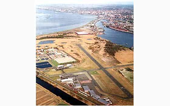

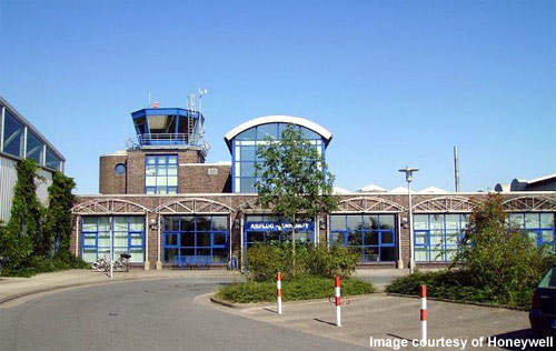


Bremerhaven is a small local airport on the coast of northern Germany, in the town of Luneort about 7.6km (4.7 miles) southwest of Bremerhaven. The airport has two daily domestic flights operating to Düne Island (Heligoland) and Heide–Büsum. The airport, however, is mainly a private flying club. The airport systems were upgraded in 1999-2000 to give the airport regional status. Despite the upgrade, the facility will continue to serve just the local area, albeit with a higher level of efficiency and improved safety. The airport has seven hangars with a total area of approximately 6000m² for aircraft storage and maintenance. Additional hangars are planned for a future expansion project. The airport has a growing function based on operating business flights to Scandinavia, Western and Eastern Europe, and operating small tourist aircrafts to the islands of the North Sea.
The upgrade included the extension of runway 16/34 (3,937ft, 1,200m, which is paved with asphalt), the installation of airport lighting and the installation of an airport navigation system.
Recommended Buyers Guides
PROJECT MAKE-UP
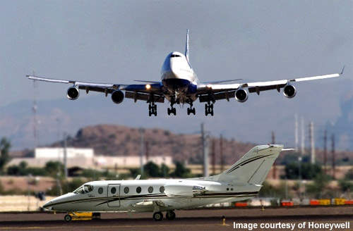
The newly expanded airport used the Honeywell/Pelorus SLS 2000 satellite landing system. In addition to this, the airport had an approach lighting system installed, also sourced from Honeywell.
Installation of the SCAT I SLS 2000 ground reference station began in the autumn of 1999. The Lufthansa Flying School assisted in the development of the approval process for the ground station. An agreement was processed under which the Lufthansa Flying School training aircraft were equipped with Honeywell and Trimble avionics to gain experience in the operation of the precision approach landing system. This arrangement allowed the system to be tested and for the pilots to get used to it.
TECHNOLOGY
The SLS 2000 landing system was jointly developed by Honeywell and Pelorus Navigation Systems, both North American companies. The technology is the result of continuous engineering evolution since the mid 1980s. The Honeywell/Pelorus SLS 2000 uses the constellation of 24 global positioning system (GPS) satellites in orbit approximately 20,200km above the earth to provide highly accurate navigation information to pilots on commercial aircraft.
DIFFERENTIAL GPS
According to Honeywell, differential GPS (DGPS) is the first major innovation in aircraft navigation technology since the implementation of the instrument landing system (ILS) technology that has been in use worldwide since the 1940s. It was the first system of its kind to receive full Federal Aviation Administration (FAA) approval in 1998.
The DGPS signal allows an aircraft to set a precision customised approach flight path that can avoid dangerous obstructions such as mountains, operate in vision-obscuring weather conditions and manoeuvre between heavily populated areas. Combined benefits include: increased safety and efficiency; reduction of flight delays due to weather and air traffic congestion; and maximising fuel and time efficiency. Precision aircraft approaches also help in noise abatement in the areas surrounding the airports.
JOINT INITIATIVE
Pelorus Navigation Systems is based in Calgary, Canada. Honeywell is a well-known airport technology company in the US capable of providing a wide range of products including navigation systems, airfield lighting, ground vehicle tracking and management, and total airport monitoring systems. The two companies both claim that the new system has significant cost advantages over instrument landing systems. Similar systems have been installed in various smaller airports across the globe, including airports in the Americas and the Pacific.