
Silicon Valley-based lidar technology company Velodyne demonstrates how lidar sensor technology can improve airport operations. This technology contributes to various aspects of airport operations such as crowd management, baggage and outdoor operations on the tarmac.
Lidar sensors provide a complete picture of the airport, in real time, and clearer images at longer ranges than cameras. Velodyne suggests that the quality of these images are a significant improvement compared with traditional cameras.
Discover B2B Marketing That Performs
Combine business intelligence and editorial excellence to reach engaged professionals across 36 leading media platforms.
Jasleen Mann speaks with Laura Wrisley, SVP of Worldwide Sales at Velodyne, about the company’s lidar sensor and software portfolio.
Jasleen Mann: Who are the AwV partners?
Laura Wrisley: Automated with Velodyne (AwV) is a one-of-a-kind partner program. Through AwV, Velodyne supports over 100 organisations, spurring collaboration and innovation in next-generation autonomous solutions.
AwV is a global ecosystem with partners encompassing a wide variety of applications that reflect the depth and breadth of Velodyne’s lidar sensor and software portfolio.
These applications fall into the following key markets: intelligent infrastructure, industrial, robotics and automotive, which includes AV and ADAS. AwV supports innovation for an increasing number of companies including those utilizing and deploying lidar throughout airport operations. Velodyne also supports leading university programs utilising and evaluating lidar-driven automation through cutting edge research and testing initiatives.
AwV enables partner development by connecting integrators to new business opportunities. AwV also provides focus for developing lidar applications that can increase efficiency, safety and improve people’s lives. As the use of lidar continues to grow globally across diverse industries, AwV will continue to foster the collaboration needed to make lidar ubiquitous and its benefits accessible to all.
What are the current challenges faced by airports? Why is this happening?
Anyone who’s traveling, or is updated in recent news, is all too familiar with the rising challenges facing airports, airlines and travelers. As droves of travelers head to the airport to make up for missed trips during the pandemic, we’re seeing an increase in flight delays and cancellations, congested TSA lines and lost luggage—which are heavily impacting consumers.
Airport congestion continues to grow, with more than two million passengers a day moving through security checkpoints at US airports for 52 straight days, according to TSA.
Additionally, airports continue to experience staffing challenges, including shortages of baggage handlers, and coupled with soaring travel demand, these shortages have contributed to lost bags. According to data from the Department of Transportation, airlines mishandled baggage at much higher rates in comparison to April 2021—leading to nearly 220,000 bags lost, damaged or delayed in April 2022 alone.
All of these issues have led to historically high consumer complaints against airlines, rising more than 300% above pre-pandemic levels.
How does this technology work?
Lidar sensors emit pulsed light waves from a laser into the environment. These pulses bounce off surrounding objects and return to the sensor. The sensor uses the time it takes for each pulse to return to the sensor to calculate the distance the light traveled.
Repeating this process millions of times per second creates a real-time 3D map, or point cloud, of the surrounding environment. Because lidar acts as its own light source, the sensors provide high accuracy even at night, which can be critical to airport operations.
Through point cloud data, lidar sensors can inform the application’s onboard computer – such as a vehicle or robot – about its surroundings for navigation, including locating the position of objects and people to improve safety and prevent incidents.
How does lidar technology provide solutions to growing airport challenges?
Lidar technology can enhance many aspects of airport operations. Airports present a complex ecosystem where precise technology can bring great value for safety and efficiency, from terminal facilities with crowd monitoring and baggage transport to equipment and cargo movement to aircraft traffic and maintenance.
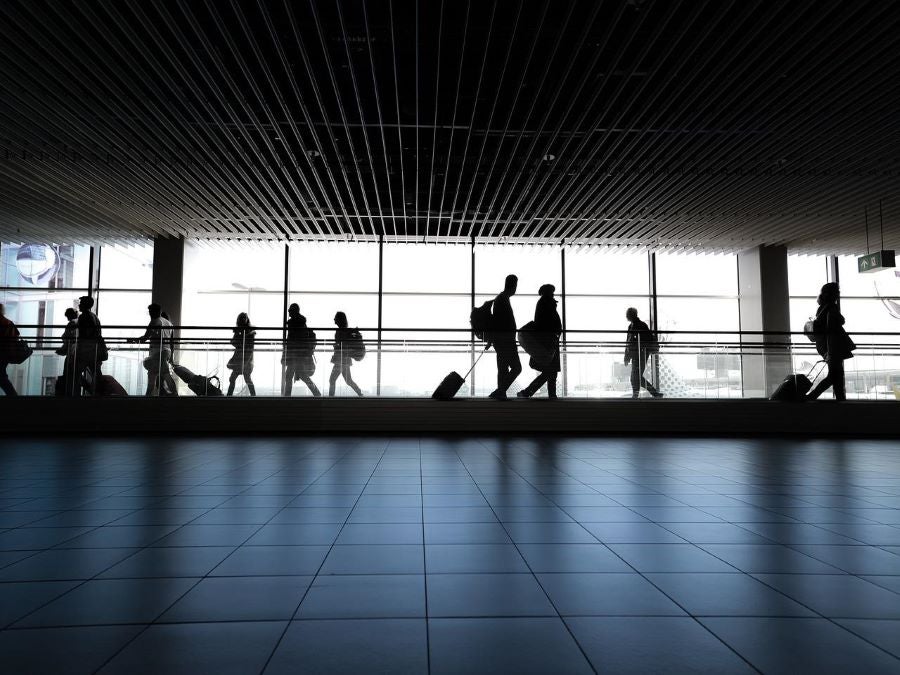
Crowd management
Airports can leverage Velodyne’s lidar and software solutions for real-time situational awareness to improve analysis and management of people flow in crowded environments. Benefits include improved queue and asset management, optimisation of the passenger journey and enhanced compliance and safety.
With lidar and real-time data analytics, airports can track people and objects in a way that preserves anonymity and trust while using resulting insights to make actionable decisions and improve crowd flow. For example, using real-time information to enable rapid decision making, an airport could open an additional TSA line to alleviate congestion.
Baggage transport
ThorDrive, a full-stack developer of autonomous driving technology for the aviation, industrial and Tier 1 automotive markets, has developed autonomous solutions leveraging Velodyne’s lidar for the safe and efficient movement of materials, cargo, baggage and people.
Equipped with multiple Velodyne Ultra Puck sensors, ThorDrive utilises lidar to power its cargo and baggage ground support tractors in a groundbreaking autonomous vehicle (AV) program at the Cincinnati Northern Kentucky International Airport (CVG).
ThorDrive’s proof of concept aims to advance airport safety and cargo efficiencies. By leveraging ThorDrive’s solution, airlines are able to autonomously transport baggage and cargo to and from planes and throughout facilities at any time, day or night. Safe, effective materials transit is critical to airlines for the protection and handling of goods while maintaining tight flight schedules
Additionally, Velodyne and TLD, a global leader in ground support equipment, have an agreement through 2023 for TLD to use Velodyne lidar sensors in production of its TractEasy autonomous electric baggage tractor.
TractEasy is a zero-emissions tow tractor that transfers baggage and freight from airport terminals to aircraft areas on service roads, with a driverless approach. It can also handle ground transportation of goods at industrial sites and logistics centers – both indoor and outdoor. TractEasy can drive up to 25 km/h and has a maximum traction capacity of 25 tons. The tractor enables a significant increase in productivity, efficiency and labor savings in airport and industrial operations.
Outdoor monitoring
Airports can leverage Velodyne’s lidar and software to improve the safety of workers on the tarmac and advance efficiency of outdoor operations. Velodyne’s full stack solutions deliver robust analytics in real time to predict, diagnose, and address operational and safety challenges. It also works in all weather and lighting conditions year-round which is essential in the around-the-clock environment of an airport.
How does this differ from previous solutions?
Many crowd and outdoor monitoring technologies for airports leverage cameras. Unlike cameras, lidar sensors create a high-resolution 3D map of the surrounding environment and can “see” up to 300 meters on all sides with accuracy within a few centimeters. This enables facility managers to view a complete picture of an entire airport environment in real time.
Additionally, compared to cameras, lidar produces measurement data that generates a clearer image at longer ranges, in a wide variety of weather and environmental conditions, 24/7. With real-time situational data analytics, solutions leveraging lidar can make improvements to airport operations.
Lidar maintains and protects privacy because it does not collect biometric data, such as facial features or skin tone. This is critical to preserving public trust as data protection and anonymity become an ever-growing public concern.
