

London Gatwick Airport in the UK has used Esri UK’s Geographic Information System (GIS) to create a geospatial platform designed to better inform construction projects at the airport and their impact on the environment.
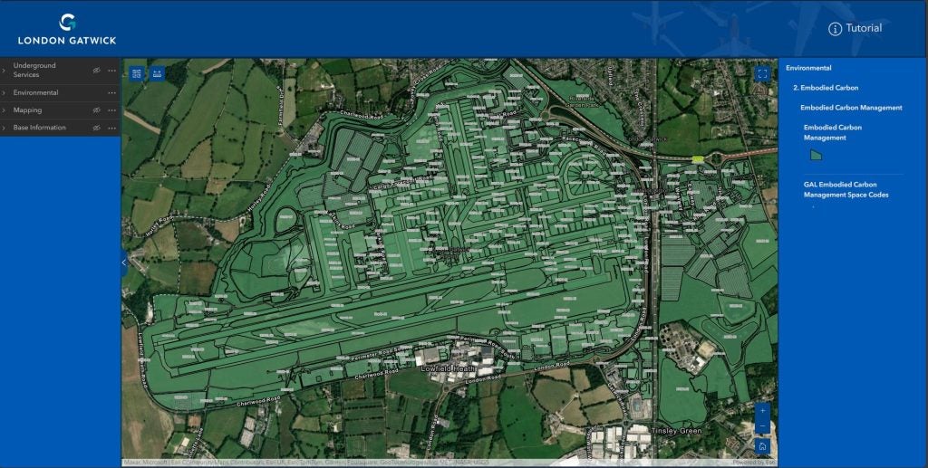
The new platform combines a variety of data sources for the airport to create a digital map showing the location of buried assets such as gas, electricity, telecoms, water, and fuel connections, and information about sensitive environmental areas.
Go deeper with GlobalData

Discover B2B Marketing That Performs
Combine business intelligence and editorial excellence to reach engaged professionals across 36 leading media platforms.
Simon Richardson, Gatwick’s digital information lead, said: “The new GIS supports our Master Plan, which includes delivering efficiencies through new technologies and process improvements, while bringing passenger service benefits and protecting the environment we operate in.
“It provides an immediate understanding of operational infrastructure, supporting faster and more informed decisions, which are integral to the running of the airport.”
Gatwick said the technology would allow for safer operations during the 50 engineering and construction projects taking place at any one time on its 1,600 acre site, which includes 75 hectares of woodlands, grasslands, and wetlands.
In addition to the infrastructure data collated on the platform, Gatwick will also be able to access information about the notable and rare species found across its site, including notable birds and bat box locations, to better inform how projects can support its Biodiversity Action Plan aiming to achieve a biodiversity net gain by 2030.
Additionally, the platform will visualise the estimated embodied carbon of built assets and allow the airport to see the “carbon price” of its assets and the potential emissions of their demolition or replacement.
The airport moved across to Esri’s Managed Cloud Service GIS system after its previous spatial data platform supplier, Autodesk, stopped support for the Infrastructure Map Server software in 2018 and discontinued further subscriptions to the product.
In the future, Gatwick says it plans on making the data on the new platform available to local planning authorities that border the airport to streamline the planning process and inform optimal sites for renewable energy projects, such as solar panels, as part of the airport’s Decade of Change sustainability roadmap.
At the end of last year, Gatwick’s sustainability ambitions, which include reaching net zero emissions by 2040 and net zero for scope 1 and 2 emissions by 2030, saw it achieve a Level 4+ Transition certification from the Airport Carbon Accreditation organisation.