
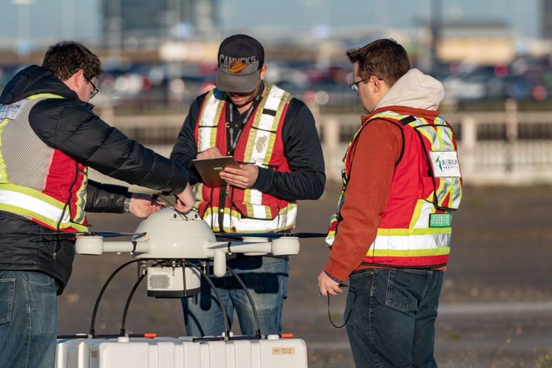
Edmonton International Airport (EIA) in Canada has announced that it used a specialised drone to carry out runway safety inspections this weekend.
On behalf of EIA, AERIUM Analytics flew Microdrone md4-1000 to gather imagery data and Lidar (Light Detection and Ranging) of the runways.
Go deeper with GlobalData

Discover B2B Marketing That Performs
Combine business intelligence and editorial excellence to reach engaged professionals across 36 leading media platforms.
The airport noted that it will use the collected data to forecast the need for preventative maintenance on runways, taxiways and aircraft handling aprons.
The airport collaborated with NAV Canada to approve the Remotely Piloted Aircraft System (RPAS / drone) operation.
This is part of the current AERIUM RPAS operations at the airport. EIA is the only Canadian airport that uses this technology.
EIA Operations and Infrastructure vice-president Steve Maybee said: “RPAS technology is advancing quickly and is more and more useful to EIA.
“Thanks to the hard work of our operations team and our partners in NAV Canada and AERIUM Analytics, our airport is a leader in this field and we are fast approaching the point where drones are just part of the regular flight operations at EIA.”
EIA maintains two million square feet of runways, taxiways and aircraft handling aprons. It conducts yearly pavement inspections to improve safety.
AERIUM Analytics has operated RPAS at the airport for four years.
In 2017, Clear Flight Solutions (CFS) and AERIUM Analytics deployed Robird and integrated drone technology at EIA to control bird activity.
AERIUM has used drones to conduct 3,000 safe airport flights and undertake many construction and maintenance surveys at EIA.
AERIUM Analytics Operations vice-president Jordan Cicoria said: “Yesterday’s flights are the result of months of planning and would not have been possible without the support we received from the airport and coordination with NAV Canada.”
