
From December 2006, aviation weather users will receive detailed updates on in-flight icing, which can endanger commuter planes and larger commercial aircraft.
Graphical displays, developed by researchers at the National Center for Atmospheric Research (NCAR), will for the first time rate areas by icing severity and the probability of encountering icing conditions.
Go deeper with GlobalData

Discover B2B Marketing That Performs
Combine business intelligence and editorial excellence to reach engaged professionals across 36 leading media platforms.
The enhanced in-flight icing product is
intended to increase safety and reduce flight delays by guiding aircraft away from potentially hazardous icing conditions, thus saving the aviation industry more than $20m a year in injuries, aircraft damage and fuel.
The displays are part of an upgrade to a system called the Current Icing Product (CIP). They will be available to air traffic controllers, pilots and other aviation weather users. The product has been developed at NCAR with funding from the Federal
Aviation Administration (FAA).
“This is a major advance that will enable dispatchers and even pilots to choose flight paths that avoid icing conditions,” says Marcia Politovich, who oversees in-flight icing research at NCAR. “This product will help make commuter flights safer, and
it will also enable commercial airlines to avoid the delays and excessive fuel costs associated with in-flight icing.”
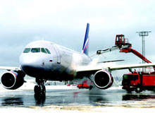
Icy weather, including ice pellets and cloud droplets that freeze on contact, may affect air travel anywhere in the world, especially during colder months. When ice builds up on aircraft wings, it can increase the drag on the aircraft and make staying
aloft more difficult. Even when aircraft are certified to fly in icy conditions, the risk can prompt pilots to detour for hundreds of miles.
UPGRADING A PROVEN PRODUCT
In 2002, the FAA approved the first version of the CIP as a tool for dispatchers to make fly / no-fly decisions, plan flights, change routes and select altitudes. The high-precision maps and plots displayed online were derived from surface
observations, numerical models, satellite and radar data, and pilot reports.
The new version of the CIP, which is updated hourly with selectable altitudes up to 29,000ft, incorporates more advanced weather prediction models and more detailed observations.
Instead of simply indicating the potential for icing, it quantifies the
probability of icing encounters and their likely severity. Pilots of properly equipped aircraft will be able to fly through areas of light icing instead of detouring around wide regions with potential icing conditions.
A major advance on the previous version of the CIP is that pilots will be able to access the maps in the cockpit, helping them to make course adjustments as needed.
SMALLER AIRCRAFT TO BENEFIT MOST
The new version of the CIP will most benefit commuter planes and other smaller aircraft, says Politovich. Such aircraft are more vulnerable to icing hazards because they cruise at lower, ice-prone altitudes, below 18,000ft. They also lack the
mechanisms – common on larger jets – that prevent ice build-up by heating the front edges of wings. Using the CIP displays, controllers will be able to guide incoming commercial jets so they avoid circling at altitudes where ice could
accumulate.
A study by the National Transportation Safety Board found that in-flight icing was responsible for dozens of accidents a year, mostly among smaller, general aviation aircraft. An estimated 819 people died in accidents related to in-flight icing from
1982 to 2000, with most accidents occurring between the months of October and March, according to the study. Between 1994 and 2001 alone, there were three major US aircraft icing accidents, with 97 fatalities, along with many other icing incidents in the
regional aircraft fleet.
Cancellations and delays due to icy weather can cost airlines millions of dollars in a single day. On 20 March 2000, Denver International Airport was overwhelmed by an unusually large number of aircraft that, after circling because of heavy air
traffic, landed with heavy ice build-up and then needed de-icing treatment before taking off again. As a result, hundreds of flights were cancelled, at great cost.
TESTING AND OPERATIONS
The National Weather Service will operate the enhanced CIP from the Aviation Weather Center in Kansas City, Missouri. The CIP will supplement but not replace the information in the NWS AIRMET, the traditional weather alert issued at six-hour
intervals.
Commuter pilots at Air Wisconsin, Atlantic Coast, ComAir and SkyWest tested the technology and gave researchers feedback throughout the development process.
Maps showing the extent and severity of potential icing at 9,000ft are displayed by the new CIP system. The red areas show supercooled large droplets (SLD) that maintain their liquid state at or below 0°C. These larger drops of water, found in
freezing rain and drizzle, can pose a special hazard to all aircraft, so the red indicates regions that all aircraft should avoid.
As from December 2006, pilots, air traffic controllers and other aviation weather users can select different altitudes through the CIP’s interactive web display to see the severity of potential icing anywhere over the continental US. In this way, the
CIP can help them avoid the icing conditions that can have such serious consequences.
